



























Medieval Map of Italy
58.00€
sale Price:58.00€
218.00€ 250.00€
sale Price:218.00€
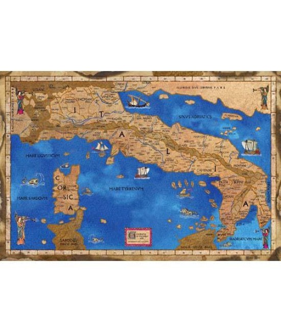
Medieval Map of Italy
The map of medieval Italy is known comes from the first edition of "Geography" of Ptolemy that has ever been accompanied by maps, printed in Rome in 1478.
It reflects the peninsula by resorting to information provided by the Alexandrian scholar in his work a thousand years before and therefore it is accompanied, in a now outdated, with the names of existing cities in the Roman period and the names of the people who once inhabited the peninsula and that year of publication were no longer present.
Made of color printing on vellum copy of the original drawn and painted by hand. Dimensions 66.5 cm x 44.5 cm.
Supplied rolled in a tube elegant hardback with aluminum caps.
66.5 x 44.5 cm. - Parchment paper
- Stock: In Stock
- Model: 1150
- SKU: 1150
39.00€
sale Price: 39.00€